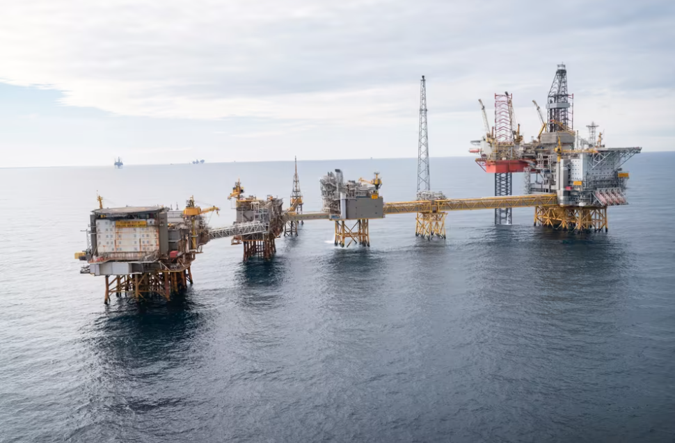

5. The marine environment, offshore operations and management
Norway is a maritime nation with the goal of integrated and ecosystem-based management of marine resources and ecosystems.
In addition to the ocean management plans, other overlapping processes within ocean management are also taking place, such as marine conservation and the follow-up of international commitments (the Kunming-Montreal Global Biodiversity Framework) as well as the development of industry plans. Offshore Norge believes that it is important for ocean management to continue to be integrated and sees the ocean management plan as the primary tool to ensure this.
The Nature Diversity Act with supporting documents (including Ot.prp. No. 52 2008-2009) makes it clear that the precautionary principle should only be applied if there is a risk of "serious or irreversible" damage to biodiversity. It is clearly stated in the Nature Diversity Act and supporting material that the precautionary principle should be used at a decision-making level. The precautionary principle should not be applied just in case nor in situations of general or hypothetical uncertainty. The principle ensures that uncertainties are considered within a professional, fact-based, and scientifically supported decision-making framework. It is not advisable for the precautionary principle to be incorporated into the scientific basis and presented to decision-makers as an exaggerated potential for damage, an expansion of possible outcomes, or an increased uncertainty. The role of science and scientific institutions is to present the best factual understanding and the most accurate estimates, highlighting the actual range of outcomes and the uncertainty inherent in the data.
The precautionary principle does not imply that the risk must be zero. In administrative areas where the precautionary principle is well-integrated into decision-making processes, decisions are also based on an acceptance of risk, and the precautionary principle is considered alongside cost-benefit assessments.
5.1 Integrated ocean management plans for the Norwegian sea areas
In April 2024, the Norwegian government presented a Storting white paper relating to "Norway's integrated management plans for the Norwegian marine areas. Barents Sea, the areas off Lofoten, the Norwegian Sea, North Sea, and Skagerrak", hereinafter referred to as Meld. St. 21 (2023–2024). The white paper clearly states that the purpose of the management plan is to create value through the sustainable use of marine area resources and ecosystem services while maintaining the structure, function, productivity, and biodiversity of ecosystems. Currently, there are primarily three major marine industries in Norway that are considered in the management plans. These are fisheries, shipping, and petroleum activities. Additionally, new industries such as offshore wind, CCS, mineral extraction, and aquaculture (outside 12 nm) are also included.
The management plans are a good and democratic tool, and Offshore Norge's members have been, and will continue to be, active contributors to building knowledge about the marine areas on the NCS and the impact that various industrial activities can have on marine natural resources. The petroleum industry has for many years been an important contributor to building knowledge about environmental values and the environmental impact of its activities on the NCS. It is important that this knowledge also becomes part of the professional basis and is utilised in the management of marine areas.
Offshore Norge actively works with our members to highlight this knowledge and participates with input. In this update cycle, Offshore Norge has participated in input meetings and submitted written input on the SVO report regarding environmental values, responses to factual errors/omissions in the factual basis, responses to the final factual basis and responses to the Storting white paper on ocean management plans for the Norwegian marine areas (2023–2024). The next revision of the ocean management plans is under way, and data about updates on the scientific basis can be found on Havforum.
The participation of interest groups is an important part of ecosystem-based management. In the process leading to the final professional basis for the management plan, the involvement of industries has been significantly weaker than in previous updates of the professional basis. The Storting white paper released in April 2024 now proposes the development of a concrete plan for involving affected interest groups in the work on the professional basis for the next management plan paper. Offshore Norge has provided responses to a new plan for involvement.
It is important that the management plan remains the overarching governance tool for Norwegian marine areas alongside relevant sector regulations.
5.2 Particularly valuable and vulnerable areas
Particularly valuable and vulnerable areas (SVO) have been identified through ocean management plans for marine areas. These are areas that, based on natural-scientific studies, are of key significance for biodiversity and biological production and where any adverse impact may have long-term or irreversible effects. The areas have been identified based on the EBSA criteria (Ecologically or Biologically Significant Marine Areas), an internationally recognised methodology for identifying environmental values in the sea.
SVOs do not have direct effects in the form of restrictions on industrial activity but signal the importance of exercising particular caution in these areas. Such caution is maintained through management measures, for example, through area-specific frameworks for petroleum activities. This can include restrictions such as drilling time limits, environmental mapping, measures to reduce the risk of acute discharges and emissions or long-term environmental damage, and requirements for monitoring and environmental assessments to follow up on the impact of petroleum activity. Considerable resources are spent on mapping, environmental monitoring, impact studies, and risk analyses in all phases of petroleum operations, to enable sound assessments of any operational limitations or mitigation measures.
In Meld. St 21 (2023–2024), there are 19 SVO areas, which is a consolidation of several previously defined areas, adjustments of earlier distributions, as well as the introduction of new areas. The number of SVOs is fewer, but the total area is significantly larger (approximately 60 percent of the Norwegian economic zone). Knowledge of vulnerability and distribution of environmental values in time and space is therefore essential for making sound assessments of any operational restrictions imposed on business activities. Both authorities and project developers can avoid costly restrictions on activities when vulnerable environmental resources are absent, or when the planned activities do not impact the resources in question. The white paper emphasises that area-specific frameworks for activities should not coincide with SVO boundaries and that management measures should be based on the best available knowledge of the distribution of environmental values in time and space.
5.3 Marine protection/international agreements related to biodiversity
Measures for conservation, sustainable use, and expertise are key components of comprehensive marine management. Conservation of areas can be achieved through marine conservation and other effective area-based conservation measures and is mentioned in St.meld.no. 29 (2020–2021) Comprehensive National Plan for the Conservation of Important Areas for Marine Nature. Marine conservation areas can be established under the Nature Diversity Act. This law has a limited scope on the NCS, and the rule for establishing marine conservation areas does not apply beyond 12 nautical miles. Area-based measures can be implemented based on sector legislation, and this has been done, for example, within fisheries management, where several coral reef areas are protected against harmful impact from fishing activities.
Norway has also signed several international conventions and agreements on biodiversity and has actively contributed to implementing them. The UN Convention on Biological Diversity was adopted in 1992, and in December 2022, a revised nature agreement was adopted in Montreal, “Kunming-Montreal Global Biodiversity Framework". The new agreement includes specific targets for conservation, restoration, and financing, and states that 30 percent of all nature (land and sea) must be protected by 2030. The goal of conservation can be achieved through two main criteria: 1) Protection and 2) Other effective conservation measures (OECM).
The Norwegian government presented a white paper with Norway's new action plan for biodiversity in autumn 2024. The plan outlines how Norway will follow up on the Nature Agreement and aims to protect 30 percent of the country's land area. However, the government has announced that a target for marine areas will not be set until the process of determining which areas can already be considered protected has been completed. In the summer of 2024, the Norwegian Environment Agency submitted a new legislative proposal for consultation to establish a legal basis for the protection of marine nature outside territorial waters. Offshore Norge submitted its response, emphasising early stakeholder involvement, a solid knowledge base for assessing areas for protection, and the integration of protection processes into management plan development. The bill will be considered by the Norwegian parliament in spring 2025.
5.4 Environmental risk and the precautionary principle
Historical data from the NCS shows that over the course of 50 years of oil and gas activity, no unintentional spills have occurred that have caused significant environmental harm, either from offshore operations, related transport, or associated onshore facilities. This does not mean that the industry claims a serious incident cannot occur from its operations.
5.5 Environmental monitoring
The industry has invested significant resources in understanding which discharges could cause an impact, so that the most effective measures can be implemented. This commitment includes environmental mapping and monitoring to assess its condition, developing better methods for environmental monitoring, and conducting research. Measures include both preventive actions and mitigation measures, such as the substitution of chemicals (see Chapter 9.3) and oil spill preparedness.
A key part of this work is the comprehensive annual environmental monitoring of the NCS. Environmental monitoring on the NCS has been ongoing for nearly 50 years. The goal of the monitoring is to document the environmental condition and development, both as a result of human impact and natural variations. In addition, there is significant research activity organised by individual companies. This includes both the development of monitoring methodologies and a better understanding of the impact on the marine environment from the petroleum industry’s discharges.
Today, monitoring is conducted in accordance with Sections 52–56 of the Activities Regulations and the Norwegian Environment Agency's guidelines M-300. The scope of the monitoring is to be aligned with offshore petroleum activities in each region and adapted to the risk of pollution. Operators collaborate on the planning and implementation of the monitoring programmes. This cooperation enables a more effective and coordinated approach to environmental protection, while also promoting the use of best available techniques (BAT). The environmental monitoring is carried out by independent consultants according to guidelines and requirements from environmental authorities. The scope, methods used, and results are reviewed and quality-assured by an expert group on behalf of the Norwegian Environment Agency.
Monitoring includes studies in the water column, of seabed sediments, and benthic fauna. Additionally, visual mapping of the seabed is conducted in areas with presumed particularly vulnerable species, such as corals and sponges. Data from the environmental monitoring are shared with Mareano. Mareano is an interdisciplinary programme for mapping the seabed in Norwegian marine areas, led by the NEA, with the Norwegian Institute of Marine Research, the Geological Survey of Norway (NGU), and the Norwegian Mapping Authority responsible for its daily scientific operations.
In the spring of 2025, a new peer-reviewed article by Jonny et al, was published in Marine Environmental Research. The article was funded by Offshore Norge, the companies' budgets for the monitoring programmes and the Norwegian Environment Agency. It provides a comprehensive review of Norway’s monitoring programme for the environmental impacts of petroleum activities on the Norwegian continental shelf over the past five decades. The study shows that pollution from oily drill cuttings was once widespread, but that the 1993 discharge ban has led to significant improvements in sediment quality and macrofauna communities. Today, the impact of drill cuttings is mainly limited to areas within 250–500 metres of the discharge site. Monitoring of produced water has identified localised effects near discharge sites, but no clear evidence of ecological population-level impact. The article also covers visual surveys used to map vulnerable benthic fauna and the measures taken to prevent damage.
The authors recommend a more integrated approach to monitoring, incorporating new technologies and statistical methods, and strengthening the links between sediment, water, and epifauna monitoring to meet future requirements for ecosystem-based management.
Water column monitoring
Water column monitoring includes field surveys and method development aimed at identifying environmental impacts associated with produced water discharges. Field surveys are conducted every three years and must, as a minimum, include hydrographic measurements, chemical analyses, and studies of caged organisms (mainly mussels) and free-living organisms (mainly fish). The time period between any two field surveys is used for further development and qualification of methodologies for future water column monitoring.
In 2024, water column monitoring was conducted for the Snorre A and Snorre B installations. The surveys indicated localised impact from produced water and seabed sediments, but no clear effects on fish health or the overall ecosystem. Consistent with previous studies, the effects associated with the immediate spill area were confined to within 1,000 metres of the spill.
Seabed surveys
Seabed habitat monitoring involves taking samples of the seabed to analyse any effects associated with the discharge of drill cuttings and chemicals from drilling activities. The sediment samples are analysed to assess their physical, chemical, and biological status. Certain stations have been monitored regularly for over 30 years, making the data extremely valuable for both researchers and authorities in assessing both natural occurring and anthropogenic changes to the environment over time. It is therefore of great interest to utilise this material in the ocean management work of the authorities. The monitoring programme is extremely comprehensive, covering approximately 1,000 stations on the NCS. Fieldwork and surveys are usually conducted in May and June. All data is stored in the environmental monitoring database MOD, which is publicly accessible.
A regional approach to the monitoring of each region once every three years was introduced in 1996. The NCS is divided into a total of eleven geographical regions for the purpose of seabed monitoring. Additionally, all fields to be put into operation must conduct a baseline survey before startup to document the natural environmental condition of the field. The Norwegian Environment Agency's guideline M-300 also contains detailed requirements for environmental surveys related to decommissioning activities. The need for and extent of such surveys will vary depending on the area's discharge history, vulnerability, available existing studies, and the scope of planned decommissioning activities.
The Norwegian Environment Agency and the Norwegian Radiation and Nuclear Safety Authority submitted a revised version of M-300 for consultation in the autumn of 2024. The proposed changes emphasise a more risk-based approach, reducing the overall scope while simultaneously strengthening the allocation of funds for method development. Offshore Norway supports this approach in its consultation response.
Surveys and assessments of vulnerable benthic areas
The petroleum industry operates on the NCS in the North Sea, Norwegian Sea, and Barents Sea. The industry is required to survey the seabed and benthic fauna before activities commence. This provides a basis for describing the potential environmental impact of the activities and aims to ensure that the footprint of the activities is minimised. The effects are primarily associated with the discharge of drilled rock material, commonly referred to as drill cuttings. The surveys are mainly conducted by collecting seabed samples using a grab, followed by analysis of physical properties (particle size), chemical properties (hydrocarbons and metals), and biological properties (description of biodiversity). In areas with hard substrate or the presence of vulnerable benthic habitats, visual and acoustic surveys are conducted as a substitute or in addition to grab surveys of the seabed. This is particularly important in areas with sponges and corals, which are believed to be vulnerable to particle discharges from drilling activities. The purpose of the visual surveys is to map the presence and scope of species and natural habitats that are red listed in Norway. The natural habitats of coral reefs, hard substrate coral forests, and sponge spike bottoms are considered to be near threatened. Visual monitoring is an effective tool for mapping occurrences and avoiding damage to the natural environment.
Offshore Norge's guidelines for vulnerable benthic habitats were updated by DNV in 2023. The objective of the guidelines is to prevent physical damage to coral reefs and sponge areas, etc.